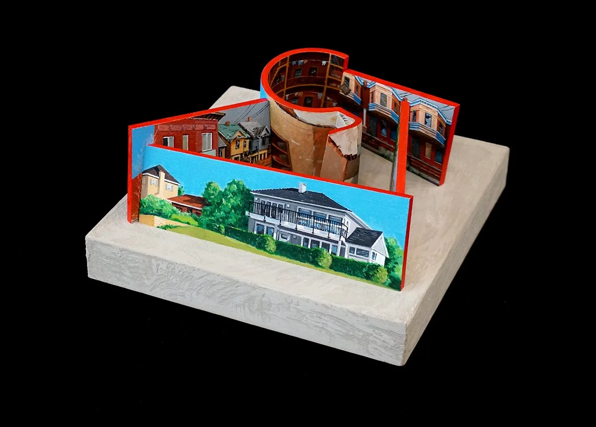
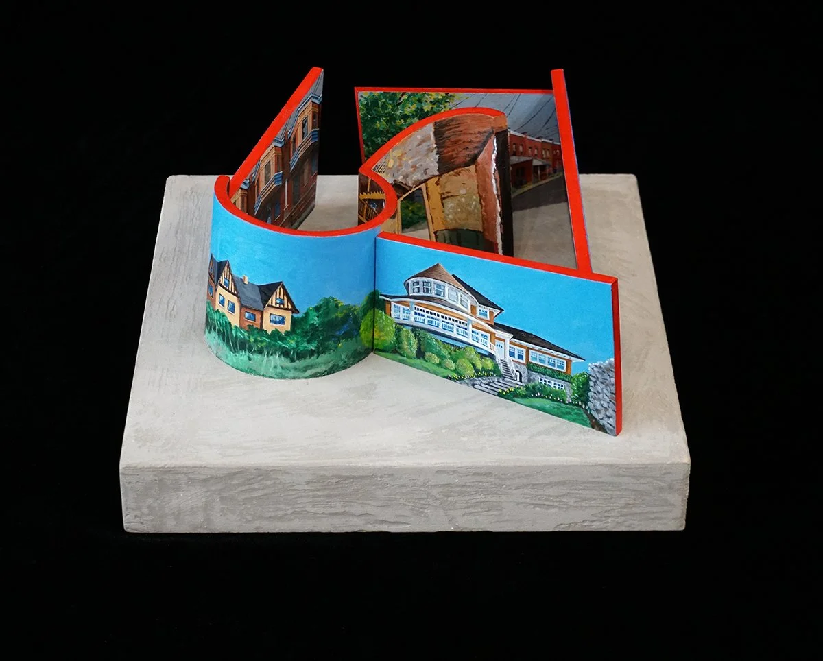
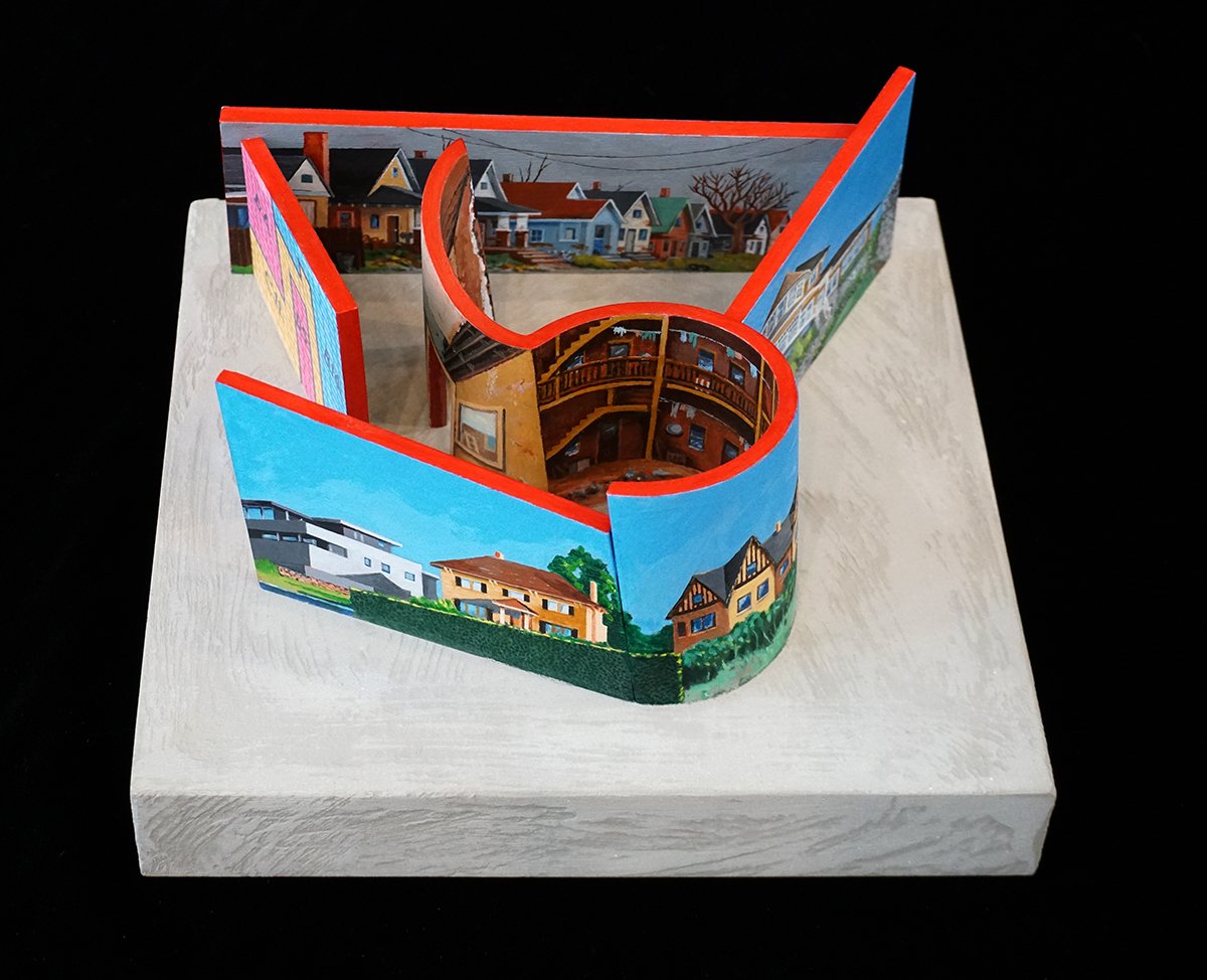
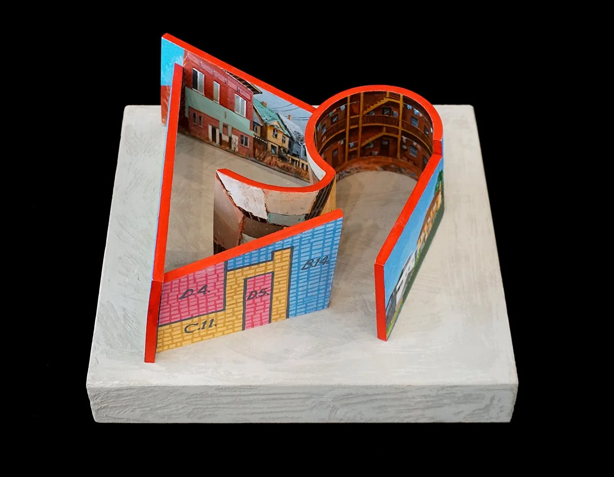
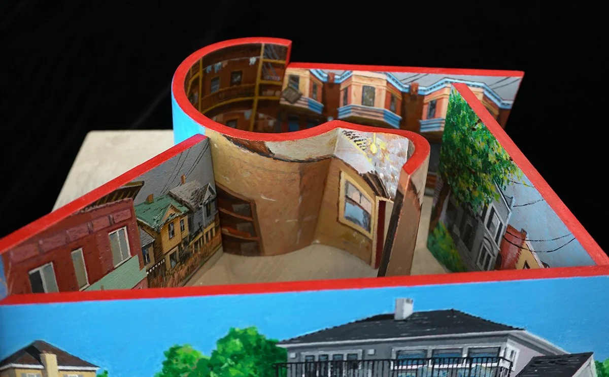
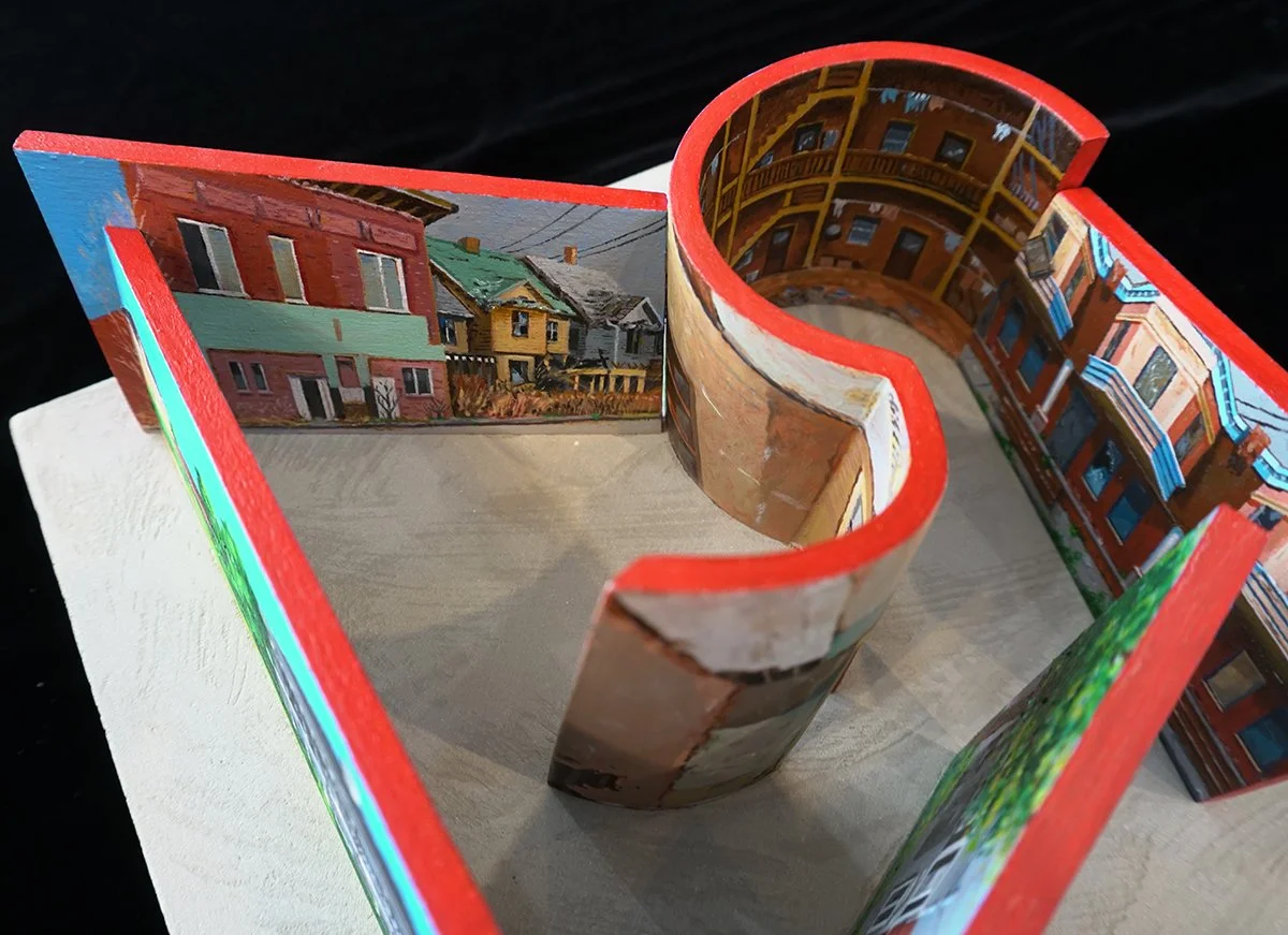
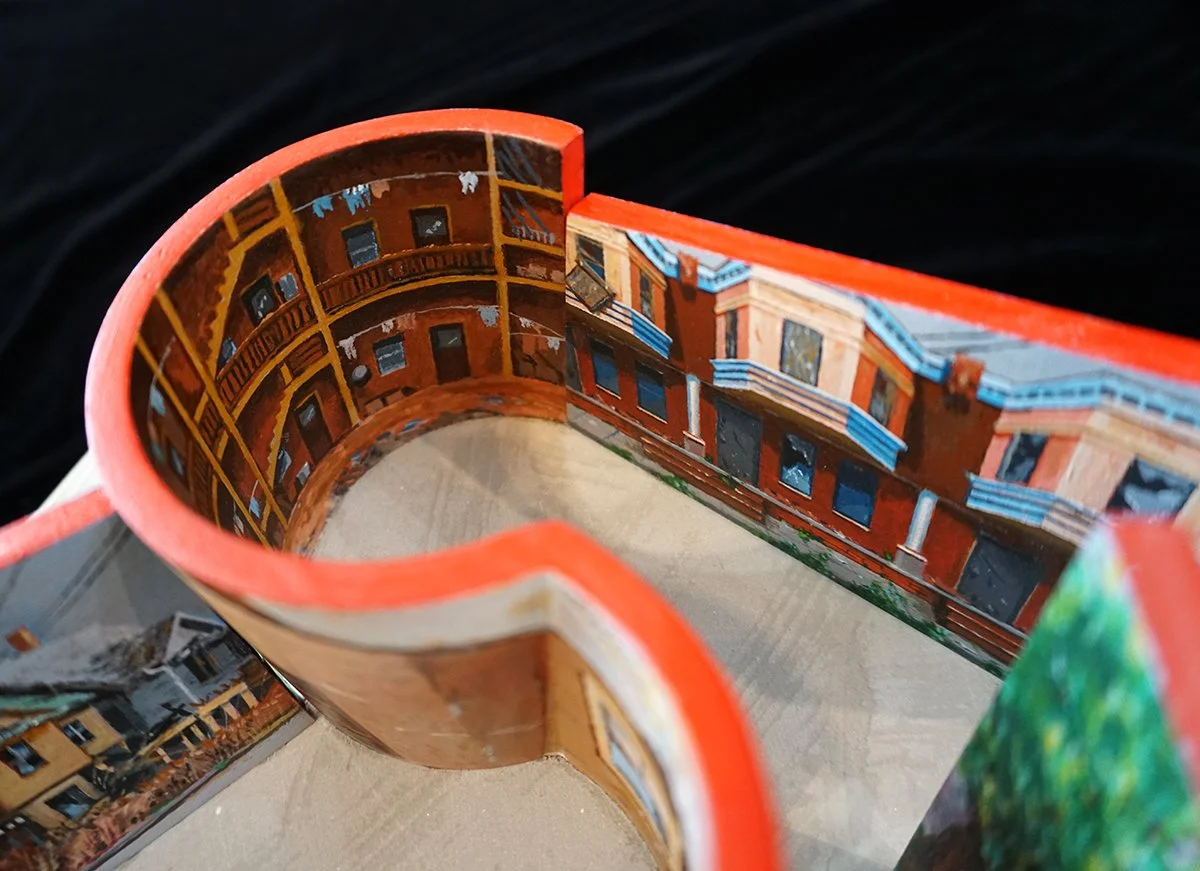
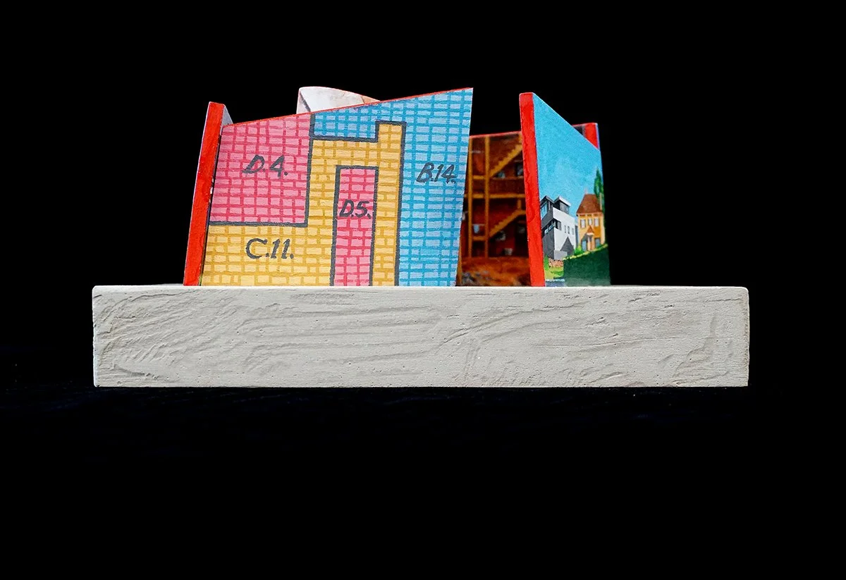
2040 Series: Redlining; Trapped 10”x 10”x 6”
Throughout the United States from the 1920s to the early 1970s, Black people and people of color (BIPOC) were segregated within cities and towns by maps and legislation that prevented them from living in “White” neighborhoods. The wall in this piece that looks like a map is from a 1939 map in Seattle that drew those boundaries, keeping people of color away from white neighborhoods. The percentage of people who could afford to own homes was low in the BIPOC communities and therefore, wealth from the sale of those homes was not able to be passed down to the next generation. Another example of Systematic Racism in the United States. Fully built, this installation would be approximately 27’x 23’x 12’. This reality is not only wrong, it is an extension of political thinking that has not gone away.